Drone Technology Enhances Emergency Response
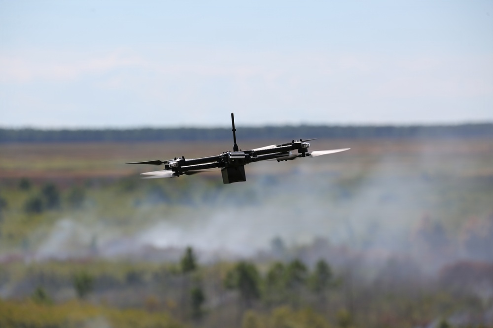
CAMP LEJEUNE, N.C. – The Fire and Emergency Services Division (FESD) at Marine Corps Base Camp Lejeune is employing small, unmanned aircraft systems (sUAS) to equip incident commanders with crucial aerial data during fire and emergency response missions.
Launched in 2024, the sUAS program integrates drone technology into operations, particularly for wildfire management and other emergencies. These drones are equipped with visual and thermal imaging capabilities, allowing responders to evaluate fire conditions, recognize potential hazards, and make informed decisions regarding the deployment of personnel and resources.
Improving Safety and Efficiency
Douglas Ackley, a firefighter with FESD, noted that the drone technology significantly minimizes firefighter exposure during the initial assessment of hazardous or hard-to-reach areas.
“The primary benefit is reducing exposure during reconnaissance,” Ackley stated. “A drone can provide information about a hazardous or difficult-to-access area before personnel are committed solely to determine what is happening there.”
During wildfire incidents, sUAS crews monitor visible fire boundaries, emerging spot fires, and heat concentrations near roads and other critical infrastructures. Continuous aerial surveillance allows incident commanders to track evolving conditions, assess whether the fire is nearing key decision points or crossing control lines, and identify regions that need additional evaluation.
Supporting Ground Teams
Thermal imaging aids responders in detecting residual heat during cleanup efforts, while aerial views offer insights into the relationship between a fire and its surrounding landscape, infrastructure, and ongoing response efforts. This information is vital for ground teams, helping to reduce uncertainty and enabling leaders to make better decisions as situations evolve.
“The goal is to provide information that supports a decision, not simply collect video,” Ackley said. “An incident commander may need to know whether fire has reached a particular road or which section needs closer attention.”
The sUAS team aligns its efforts with the objectives of the incident commander, transforming command inquiries into targeted scene assessments and relaying findings through established emergency-response communication channels. This capability is designed to complement, rather than replace, ground observations and existing firefighter safety protocols.
Future Applications of Drone Technology
Graham Hopkins, the sUAS program manager at MCIEAST-MCB Camp Lejeune, highlighted plans to expand the sUAS program for future operations.
Beyond wildfire response, this technology may also be utilized for various emergency missions, including searches for missing persons, reconnaissance of hazardous materials, assessments of storm damage, and pre-incident evaluations of buildings and access routes.
“The long-term value is building an aerial-response capability that can adapt as emergency-response needs and technology change,” Hopkins noted. “It gives fire and emergency services another tool to assess conditions, manage risk, and coordinate an effective response when it matters most.”
Source: Marine Corps Installations East via DVIDS