Record Flooding in Four Corners Region
In late October and early November 2026, the Four Corners area of the U.S. Southwest experienced consecutive extreme rainfall events that significantly impacted the region. While these storms provided temporary relief from ongoing drought conditions, they also led to dangerously high river levels, resulting in severe flooding.
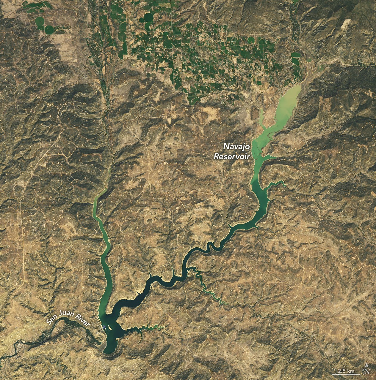
Satellite observations revealed a dramatic increase in water levels at Navajo Reservoir, which spans northern New Mexico and southern Colorado. Images captured on September 20 and November 7, 2026, using the Operational Land Imager on Landsat 9, indicated that the reservoir rose nearly 60 feet (18 meters) during that period. On November 7, the reservoir reached its highest level since August 2019, standing at 108 percent of its average capacity for that date, compared to just 60 percent on September 20. This rise was noted after the Bureau of Reclamation had reduced water releases from Navajo Dam shortly before the rainfall.
Severe Flooding Impacts Communities
The storms brought significant runoff to rivers like the San Juan and Piedra, with Pagosa Springs, Colorado, particularly affected. This community, located approximately 40 miles (64 kilometers) northeast of the reservoir, recorded over 5 inches (12.8 centimeters) of rain in the initial downpour. As a result, the San Juan River reached a major flood stage, prompting evacuation orders and rescue operations for residents as floodwaters surged through streets and damaged properties.
Flooding was widespread across southwest Colorado, southeast Utah, northern Arizona, and northwest New Mexico over the preceding weeks. Precipitation levels in the Four Corners region from early September to early November were reported to be two to four times higher than average, providing a stark contrast to the long-term drought conditions worsened by a lack of snowfall and elevated temperatures earlier in 2026.
Short-Term Relief Amid Long-Term Drought
Despite the dangers posed by the heavy rains, they also brought relief from drought to the affected areas. The U.S. Drought Monitor, utilizing satellite data and ground observations, indicated improvements in drought conditions across the Southwest following the fall storms. A summary released on November 3 stated that short-term drought had been alleviated in the Southwest and Great Basin, although long-term drought conditions persist in certain areas.
Experts noted that the wet weather patterns observed in the Southwest are often linked to El Niño events, which can enhance moisture-laden storms across the region. The low-pressure system responsible for the heavy rainfall in autumn 2026 was noted to be unusually low in latitude for that time of year and drew energy from higher-than-normal ocean temperatures. Current El Niño conditions are believed to have contributed to the increased likelihood of such storms impacting the Southwest.
The information was compiled from data and imagery provided by NASA Earth Observatory, specifically attributed to Michala Garrison, with further insights from the U.S. Army Corps of Engineers and the U.S. Drought Monitor.
Source: NASA