Nasa Monitors Significant El Niño Event
Nasa is closely observing a rare climate phenomenon known as El Niño, which is emerging this fall and is anticipated to be the strongest occurrence since 1950. This natural climate pattern, characterized by elevated sea temperatures in specific regions of the equatorial Pacific, typically occurs every two to seven years. As reported by the National Oceanic and Atmospheric Administration (NOAA), there is an 83% likelihood that the current El Niño is unfolding.
This climatic event influences trade winds, alters ocean heat distribution, disrupts rainfall patterns, and raises sea surface heights across various parts of the Pacific. The effects of El Niño are already being felt globally by diverse groups, including farmers, firefighters, and coastal communities.
Tracking Ocean Changes
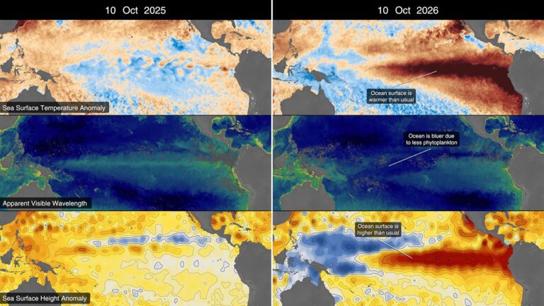
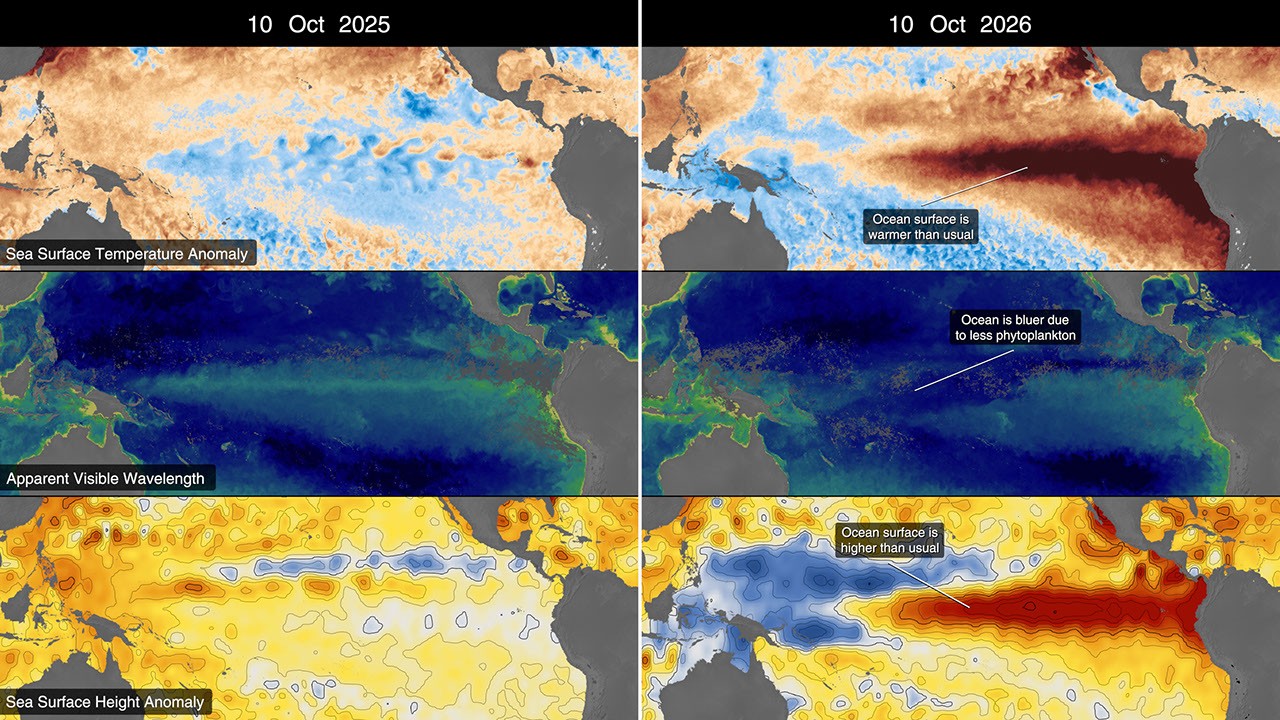
The phenomenon’s progression is being documented with high-resolution maps that compare data from 2025 and 2026. These maps illustrate fluctuations in sea surface height, sea surface temperature anomalies, and visible wavelengths. A notable initial indicator appeared in January 2026, when a Kelvin wave—a slow-moving surge of warm water—was detected near Micronesia. These waves act like highways for ocean heat, moving it eastward across the Pacific.
As this warm water shifts, it causes air above it to rise, diminishing or reversing the trade winds that normally blow from the Americas to Asia. This reaction results in increased sea levels in the eastern Pacific and further warming of the waters. By early April, the Kelvin waves had reached the eastern Pacific, with sea temperatures beginning to rise significantly. Some regions are experiencing local sea level increases of up to 1.3 feet, while areas around Indonesia and northern Australia are seeing levels drop by 6 to 8 inches.
Rising Sea Temperatures
Sea surface temperatures in the eastern Pacific are currently about 3 degrees Fahrenheit warmer than the long-term average and may increase further in the upcoming months. Satellites equipped with microwave and infrared radiometers are providing vital data on these temperature changes, mapping the spread of warmer water from the Pacific’s center to the South American coast.
These elevated temperatures have significant implications for global weather patterns, as the warmer water facilitates the transfer of heat and moisture into the atmosphere, influencing rainfall and storm distributions worldwide.
Changes in Ocean Color
El Niño also alters the color of ocean waters. NASA’s PACE satellite is monitoring these changes, revealing that the equatorial Pacific has become increasingly blue over recent months. This shift is partly due to the decline of phytoplankton, microscopic plants that are a crucial part of the marine ecosystem. Normally thriving in cool, nutrient-rich waters, phytoplankton populations diminish during El Niño events because reduced upwelling limits their food supply.
The data collected by the PACE satellite allows researchers to observe ocean coloration in detail, illustrating how the green hues typical of phytoplankton-rich areas have diminished as bluer shades take over. This year’s El Niño marks the first such event since PACE became operational in 2024, offering new insights into the phenomenon.
Continued Monitoring
Nasa scientists are committed to ongoing observation of El Niño’s developments and consequences through their fleet of Earth-monitoring satellites. The study of these climatic events is crucial, as El Niño impacts a wide range of global systems. Josh Willis, a project scientist at NASA’s Jet Propulsion Laboratory, emphasized the significance of understanding these oceanic changes, stating, “El Niño touches almost all of us in some way every time it occurs.”
Source: NASA