Vega Island’s Skull-like Formation Captured in Satellite Images
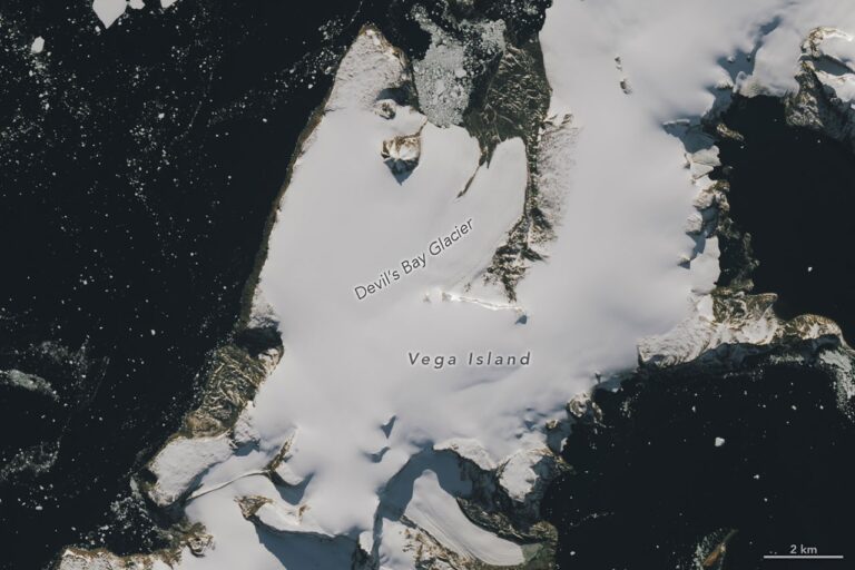
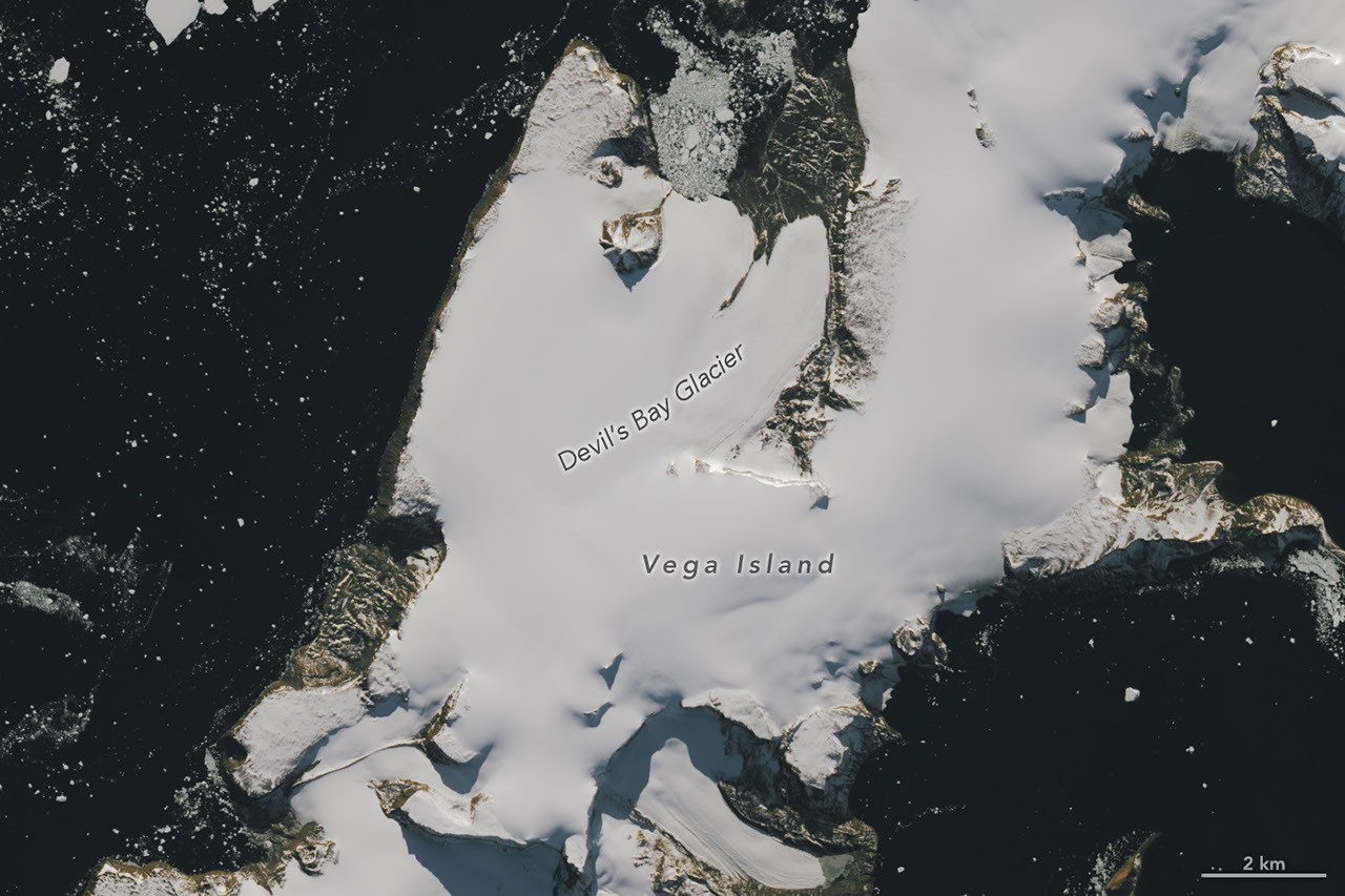
Recent satellite imagery has revealed a striking feature on Vega Island, located in the Weddell Sea, which resembles a grinning skull. This unique formation includes a rock outcrop that serves as an eye socket and a lateral moraine that appears as a mouth, creating a haunting profile of a skull facing Devil Island.
The images, taken by the Operational Land Imager on Landsat 9, showcase the island’s eerie visage during two distinct seasons: the onset of autumn in March 2025 and the following spring in October 2026. The March 2025 image displays a layer of snow covering the ice, typical for this period, while the October 2026 image reveals significant snow melt, exposing darker ice surfaces.
Impact of Climate Conditions on Ice Cover
Glaciologist Mauri Pelto from Nichols College noted that unusually high temperatures during the winter of 2026 contributed to the extensive bare ice observed in October. He explained that the lack of new snow accumulation over the winter, coupled with sublimation and wind erosion, has left much of the island exposed. “The winter season was no treat for these glaciers,” Pelto stated.
The impending melt season could exacerbate the situation, as darker ice absorbs more solar energy, potentially accelerating melting as temperatures rise. Pelto emphasized that a fresh snowfall would be beneficial in the short term, as it would help protect the ice from further degradation.
Long-term Observations of Vega Island’s Glaciers
The first extensive mapping of Vega Island’s ice was achieved with the help of Landsat imagery, dating back to a 1982 study which documented four ice caps on the island. Devil’s Bay Glacier, one of the monitored glaciers since the summer of 1998-1999, has shown a consistent decline in mass, reflecting a wider trend of ice loss across Vega Island and its surrounding glaciers.
Vega Island also has historical significance, having been part of the Swedish Antarctic Expedition from 1901-1903. During this expedition, team members faced severe challenges, including being separated and losing their ship to pack ice. A reunion of two groups took place at what is now known as Cape Well-met, located at the “forehead” of the skull formation.
These findings highlight the complex interplay between climate change and glacial dynamics on Vega Island, underscoring the urgency of ongoing monitoring and research in the region.
Images and information were provided by NASA Earth Observatory, with contributions from Lauren Dauphin and Lindsey Doermann.
Source: NASA